Xiaoyoukeng Tourist Service Station→Fonggueikou
| Starting-Ending | Xiaoyoukeng Tourist Service Station→Fonggueikou |
|---|
| Planning |
Section route: Xiaoyoukeng Service Center → Main Peak of Qixing Mountain [Activity Pillar - 西] → East Peak of Qixing Mountain [Activity Pillar - 東] → Lengshuikeng Tourist Service Station → Qingtiangang Tourist Service Station → Fengguikou [Activity Pillar - 北] |
|---|
| Walking distance | About 13 km
(Accumulated 38 km) |
|---|
| Time | Take 7-8 hoursby foot |
|---|
| Characteristic of Trail | Taipei summit
Willow meadow |
|---|


Qixing Mountain
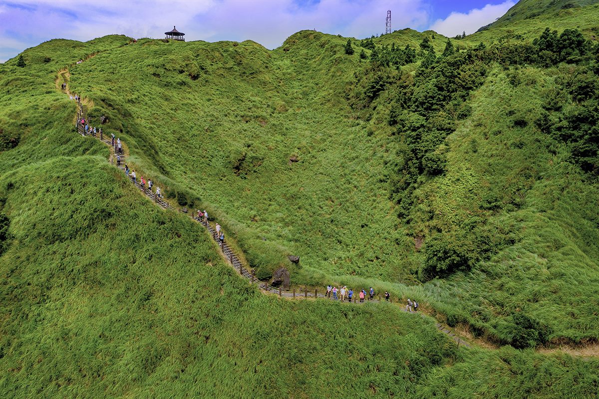
The main peak is 1,120 meters high, making it the highest peak in Taipei City, where the erosion at the top of the mountain has formed seven hills of different sizes, just like the “seven stars” of the Big Dipper, hence the name. Due to the northeastern monsoon and the fact that the south of the mountain is sheltered, there is a rich variety of biodiversity in this place, while the north of the mountain is exposed to strong winds and is highlighted by a sea of white and yellow manzanita flowers in the fall. When a breeze blows, the majestic golden waves appear spectacularly, presenting a completely different natural landscape.
Qingtiangang
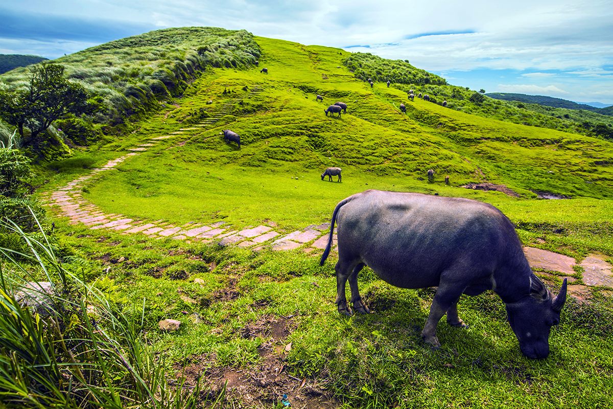
The area is located in the middle of the Tatun volcano group and is a lava terrace formed by the overflowing of lava early on from the Zhugao Mountain to the north, and because of its calm and open terrain, it has been an important area for cattle grazing since the late Qing Dynasty and the Japanese administration. In addition, due to human and grazing influences, a grassland landscape dominated by carpet-like grass has been formed, and it has become a famous mango-viewing spot in autumn.
Dingshan-Shihti Ling
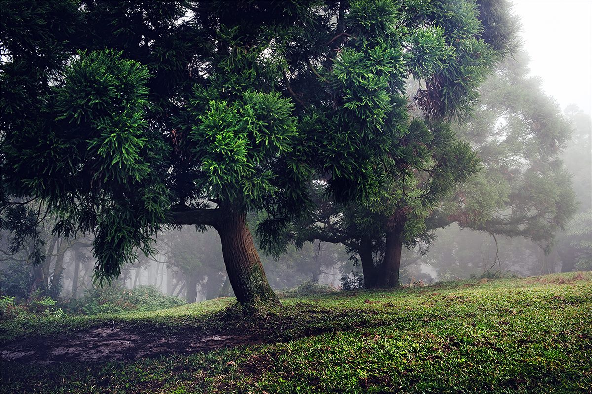
The trail is not very dynamic, but it offers a wide view and a rich variety of landscapes and ecology. For example, the uninterrupted mountain peaks, the dreamy and quiet willow forest, the green grassland, the golden azaleas that bloom in March and April on Dingshan, the Coupled Dipteris known as a “living fossil,” and the autumn and winter manzanita that sway in the wind, all display varying scenery throughout the seasons and are worth visiting.
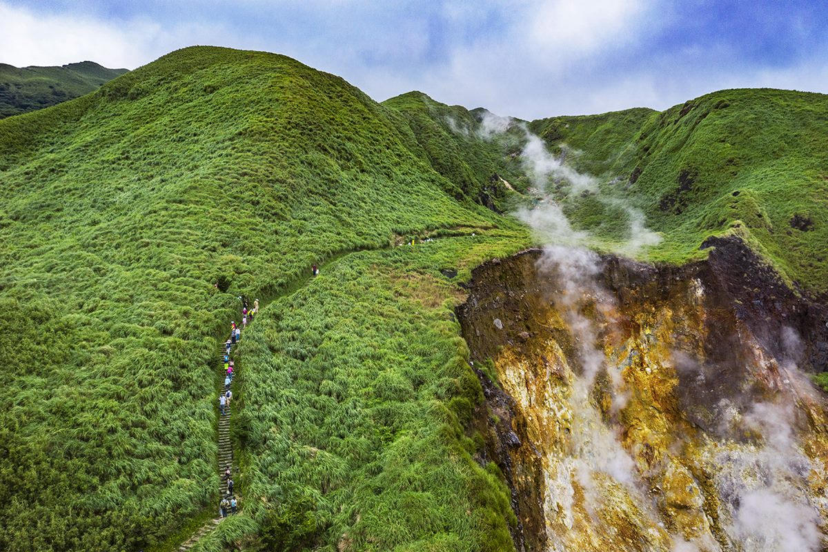
Xiaoyuokeng Volcanic Terrain
Xiaoyoukeng Tourist Service Station→FonggueikouThe most unique terrain in Yangmingshan National Park is the geothermal heat, hot springs, and vents. The most representative site is Xiaoyuokeng, a post-volcanic geological landscape with huge vents, sulfur crystals, and a spectacular collapsed terrain. From here, you can see the towering drops in the rock face with wisps of white smoke and a strong smell of sulfur pouring in. It is indeed a spectacular view.